DSCF0261We travelled for an extended weekend to the East Coast for Maverick’s wedding in New Jersey.  We did some local sightseeing including the Thomas Edison National Historic Park and Eagle Rock Reservation.  After Maverick’s wedding, we went into New York City for some touring there.  We went to the Metropolitan Museum, the Lower East Side, and Lower Manhattan over a few days.   While it was hot and  humid, we enjoyed taking in the sites. 


Here are all the photos:

http://sanjoseabrams.com/photos/NewJerseyMay2011/

We took the opportunity to celebrate two years of wedded bliss with a weekend getaway to Marin.  We stayed at a B&B that was close to the entrance to Point Reyes National Seashore.   On our first full day, we visited Samuel Taylor State Park for a hike to the fire lookout and a stop at the Stairstep Waterfall.   On our second full day, we visited Point Reyes for another eight mile hike.  It was a cold weekend, especially for May, but we were able to see the sights in any event.

All the photos are here:

http://sanjoseabrams.com/photos/MarinMay2011/

Unlike in past years, we decided on short notice to head to Yosemite.  With L’ on Spring Break and a brief lull in my workload, we went away for a few days.  Leaving on Saturday, we made it to the southern side of Yosemite for a night in Oakhurst.  This gave us an extra full day in the park compared with our prior trips, since we normally arrive very late on a Friday evening.

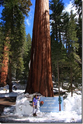
yosemite013On our first day, we did a hike and a short snow shoe walk through the Mariposa Grove of Giant Sequoias.  The hike to the grove is two miles along a snow plowed road.  When we got close to the grove, we put on our snow shoes so we could walk up to the trees and further enjoy the scenery.

From here, we headed toward Yosemite Valley.  We made an unplanned stop by the side of the road for our first view of the valley and an unexpected bonus waterfall.  We took a short walk from the parking area to get a better view of the waterfall (which I think is the Cascade waterfall, but I’m not sure).  From here, we stopped at Tunnel View for one of the classic Yosemite Valley views that never gets old.  We then finished the drive to our lodging in time for dinner.

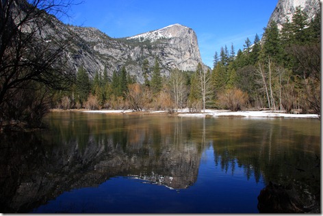
On our next full day, we learned that the road to the Badger Pass area had just closed for the season yesterday, so we had to adjust our plans.  We made a quick stop at the Ansel Adams Gallery and the Visitor Center to get some tips.   We hiked the Mist Trail to see Vernal Falls and that brought back memories of when we did a small portion of the trail on our way to Sierra Point.  Following lunch, we did the Mirror Lake trail, which is no longer a loop following a landslide a few years ago.  It’s not really a lake, but really just a part of the Merced River.  Still, the view is stunning.  We hiked beyond the lake and saw a bonus, unnamed waterfall in the distance as well.

yosemite132

On our final day before heading home, we did a snow shoe walk to the Merced Grove.  Similar to the Mariposa Grove, there are some huge trees at the end.  Snow shoeing is a great workout and we have more than earned our pizza gorging that we’ll have tonight when we return home.

View all the photos here:

http://sanjoseabrams.com/photos/YosemiteApril2011/

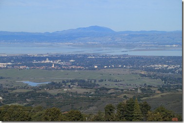
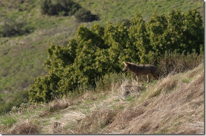
While much of the country has had snow, sleet, and freezing cold temperatures, we’ve russianridge08lucked out with a dry and pleasant January.  We’ve had above average warmth the last week or so and today it was also an exceptionally clear day.  We considered returning to San Bruno Mountain, but instead opted for another park we visited last year, Russian Ridge.  There were clear views of all the major mountains in the area (Diablo, Tam, and Hamilton) plus the ability to see the Bay and the Ocean from the same vantage point.  russianridge11To top it off, we saw some wildlife in the form of a couple coyotes, a pair of deer, and a bunny rabbit. 


Here’s all the photo goodness:

http://sanjoseabrams.com/photos/RussianRidgeJanuary2011/

After yesterday’s long day of activity on the volcano, we took it easy today.  We found a beach recommended in the guidebook for some morning lounge time.  We read and relaxed until it was lunchtime.  It was a perfect Hawaii morning.

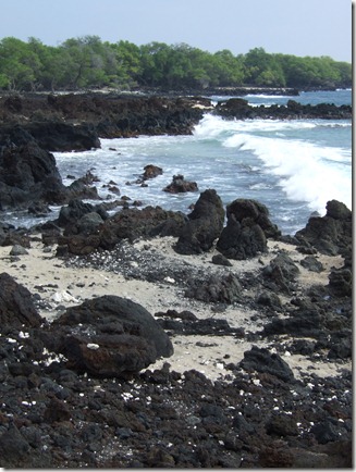
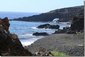
maui484After lunch, we moved on to Ahihi Kinau Natural Area Reserve to the south.  It’s mostly around old lava flows.  We do some walking on the easy trail and then take a short stop at the beach where I take a short snooze.  We then walk back to the start where there is some calm water for L’ to snorkel.  She returns quickly because the water was cloudy.

On the way back we make dinner reservations at the place we ate nearly a week ago on our first night on Maui.  Cafe O’lei had very good food, reasonable prices, and a great Mai Tai and we looked forward to dining there again.  We have an early dinner and then walk back to the hotel to pack up.  Tomorrow our vacation ends and we return to the mainland after a great trip.

View all the trip photos here:

http://sanjoseabrams.com/photos/MauiDecember2010/

The tallest peak on the island of Maui is the peak of the volcano, Haleakala.  The guide books recommend getting to the summit to watch the sunrise.  Even in Hawaii, the sunrise occurs early in the morning (can’t they reschedule it?).  We couldn’t muster a 4am wakeup, but got up at the still early time of 6am.  It took a little more than an maui409hour and a half to get to the summit.  We brought plenty of extra layers so we stayed warm at the summit where it is windy and around 40 degrees.  We take in the view from the top, including Science City which houses the scientists that are studying the sun and stars from this vantage point.

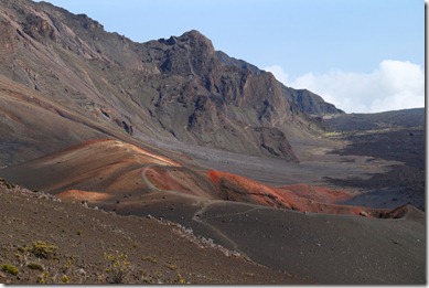
We then return to the visitor center that is just below the summit (just below 10,000 feet of elevation).  From here we pick up the Sliding Sands trail which will take us down about 1500ft over 2.5 miles to the base of a cinder cone.  Technically the "crater" we are hiking in is a valley because it was formed by erosion, not the volcano itself.

The hike begins downhill which make the first half easy, despite the elevation.  We get to the cinder cone which is neat to see.  After taking in the view, we start our trek up.  It’s strenuous because of the altitude, but we eventually make it back.  Fortunately it remains cool at this altitude so it’s not too unpleasant.

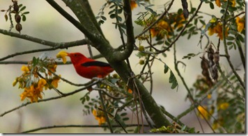
maui472Once we are back in the car, we stop at a couple overlooks on our way down and walk a short nature trail (which is neat because we see some bright red birds).  We finally depart the park and return to the hotel.  We’ll sleep well tonight after all this exercise.

View all the trip photos here:

http://sanjoseabrams.com/photos/MauiDecember2010/

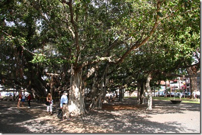
Today we took it a bit easier. After sleeping in a bit, we departed for Lahaina, on west Maui.  It was a little more than a thirty minute drive.  The town was big during the whaling days.  There are still some historic sites to see.  We check out the old prison and courthouse and the highlight of the town, Banyan Tree Square.maui313 This contains a huge tree with multiple trunks and roots.   It’s over one hundred years old.  We also visit the Wu Hing house in the old Chinatown.  The house is neat and has items from the Chinese population that lived in Lahaina back in the whaling days.  The best part are the movies out back.  They have some movies made by Thomas Edison of Hawaii.  These films are over a hundred years old.

After a yummy lunch and gelato stop, we continue up the coast to a beach for L’ to snorkel.   I hang on the beach while she swims with the fishes.  We then return back to the hotel and get dinner.  Tomorrow we are off to the top of the volcano.

View all the trip photos here:

http://sanjoseabrams.com/photos/MauiDecember2010/

There was a choice in how to return to Kihei.  We could drive back the way we came, retracing our steps, or continue along the backside of the island and make a complete loop.  The waitress at dinner the night before recommended the full loop.  We proceeded to go this way, despite the warnings about narrow roads, dirt roads and one lane bridges.  It turned out that all these warnings were greatly overblown.  Even the supposed unpaved part was minor and easy.  Our biggest issue was getting our car stuck in the mud before we even began our drive on the backside.

maui294I was driving and L’ wanted to find a waterfall that we did not see the day before.  She saw a driveway that might be a parking area to get to the waterfall and I turned in.  Thanks to the heavy rainfall the night before, the ground was wet and muddy.  The turn in was a mistake.  It was not a pull off, but just a random driveway and it was all muddy. We realized it didn’t seem right before we even got out of the car.  I put the car back in gear to drive us on our way, only the car didn’t move.  We were stick in the mud.

The two characters who were asking why we pulled in to their driveway were eventually helpful.  They helped pull our car back to the road and out of the mud (while I had my stress attack along with visions of our rental car flying down the cliff).  In the end the locals got us out and we gave them some money for their trouble. (Note that if you work for our rental car company and are reading this, none of the above actually happened).

maui278Back on our way, we stopped at a few pretty places on the road and had a glimpse of the waterfall we were trying to find in the morning (which was very neat – the waterfall went into the ocean).

The road was nowhere as bad as the hype, and it was quite easy.  We stopped at a Lavender farm Lonely Planet recommended and that was just okay.  We finally made it back to our hotel and it was good to be back in civilization again.  We had definitely earned our umbrella drinks today.

View all the trip photos here:

http://sanjoseabrams.com/photos/MauiDecember2010/

By staying in Hana for a couple nights, we had plenty of time to explore beyond the town.  We had a full day today going to O’heo Gulch, stopping at several waterfalls along the road, visiting the grave of Charles Lindbergh, and hiking to a red sand beach.  It was indeed action packed.
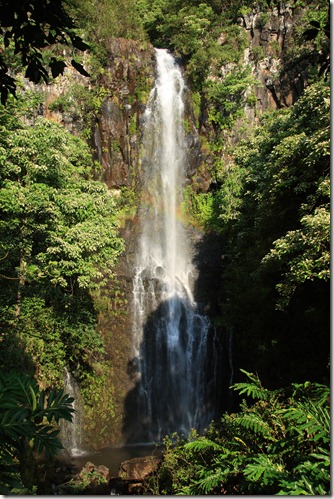
maui131We departed on our adventure to stop at a roadside waterfall. It is called Wailua Falls and was right by the road.  The sun was out and there was a rainbow through the waterfall which was very neat.  After taking the required photos, we departed for O’heo Gulch. 

O’heo is located in a national park so we pulled out our annual parks pass and ID only to determine that L’ had pulled a Zenia- she forgot her purse in the hotel room.  After driving back to get it, we were on our way again.

O’heo Gulch has been known as the "seven sacred pools".  This is wrong on two out of three accounts.  There are more than seven pools and they were never sacred to the native Hawaiians.  They are in fact pools and still very neat.  There are cascading water flows and pools where some of the earth eroded away.  The water is chilly, but refreshing in the hot weather.  We explore the lower pools and since we are here in the morning, it is not crowded. 

After a break for lunch, we start off on about a two mile hike (each way) to get to a couple of bigger waterfalls.  Except for some rain when we finally reach the furthest waterfall, it remains sunny and warm.  The waterfall is well worth the hike in.  We make it out in less time than going in and take in some views along the trail.

We now hunt down the grave of Charles Lindbergh who, battling cancer, lived out his final days on Maui.  The grave is out behind a small church.
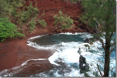
maui235Heading back towards the hotel, we search for the Red Sand Beach.  Our gps comes through and it’s just down the street from the hotel.  The short hike down is a little steep, but nothing too bad.  The beach is very pretty, even in the rain (and much better than the green sand beach we saw on our last trip to Hawaii).

By now we are sufficiently stinky and hungry that we return to the hotel to clean up and find food.  Tomorrow we return to Kihei.

View all the trip photos here:

http://sanjoseabrams.com/photos/MauiDecember2010/
For our first full day in Maui, we tackled the Road to Hana.  Hana is in Eastern Maui and the drive there is known for its scenery.  We had  a guide book, maps, and GPS, yet still managed to confuse ourselves.  It turns out that the road changes name and mile markers.  Unclear to us was that the guides we had (which indicate stops by mile marker), begin AFTER the road changes name and the mile markers reset.  Once we figured this out, then everything made sense and we were in sync with our navigational aids.

maui063

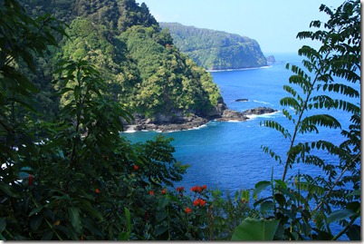
The road is very pretty and there are numerous vistas and stopping points along the way.  Thanks to our mix up in the morning we even caught some surfers enjoying the waves.  We took nearly all day to get to our hotel in Hana. By this time, we were ready for showers and some much needed food,

View all the trip photos here:

http://sanjoseabrams.com/photos/MauiDecember2010/

« Previous PageNext Page »