About a month after our wedding, we spent a weekend up in Napa Valley.  It’s a reasonable drive for a weekend and gave us some relaxation time.  We left after work on Friday (or my work), stopped in St. Helena for dinner, arriving at our B&B as it was finally getting dark.  On Saturday we went to the winery that was built like a European Castle.  The tour was neat and the wine just okay.  We bought one bottle of a tasty dessert wine.  Following lunch, I proceeded to take an afternoon nap.   I got up in time for dinner.

Outside the Castle

On Sunday we got some exercise hiking in Bothe-Napa Valley State Park.  We finished around lunch time and grabbed some unsurprisingly mediocre pizza.    We did another round of wine tasting  which was very disappointing.  For twenty bucks, none of the wines we tasted was even as good as the ten dollar bottles we buy at Safeway. Oh well.  We then headed home.

The weather was nice and warm (since June was unseasonably cool)  which was a pleasant change.  Here are the pictures:

http://www.sanjoseabrams.com/photos/NapaJune2009/index.html


Loyal readers know that we went to Yosemite back in April.  It’s been a crazy few months since then.  With a move and a wedding, there’s been precious little time to update the blog.  I had some time last weekend to sort through pictures from recent adventures.  They are slowly making their way online.

The Yosemite weekend was great.  It was my first time in Yosemite Valley, despite having lived three hours away for all these years.  We are truly spoiled to live so close to such a spectacular place.  I can see why photographers the world over trek there and go through way too many rolls of film.  We stayed in the Yosemite Lodge which is highly recommended.  The walls are thin, but the location can’t be beat.  You can see the tallest waterfall in North America from your doorstep (This is not an exaggeration).    We did our reququisite hiking (including an "advanced" hike that L’ lead me on to Sierra Point).   The weather was cool, but comfortable, and it was a needed break from a very unpleasant couple days. 

I took about 400 pictures over just a couple days.  Many of these were panoramas and multiple shots of similar subjects. I tried to whittle it down to just the highlights.  I’ve also made several of the panoramas and posted those online.  Links are below.

Photos:

http://www.sanjoseabrams.com/photos/YosemiteApril2009/

Yosemite Falls:

http://www.sanjoseabrams.com/photos/YosemiteApril2009/YosemiteFallsPano1/yosemite025_stitch.html/

Yosemite Valley and Falls:

http://www.sanjoseabrams.com/photos/YosemiteApril2009/YosemiteFallsPano3/yosemite252_stitch.html

Sierra Point (the only place in Yosemite where you can see four waterfalls) 360 degree panorama:

http://www.sanjoseabrams.com/photos/YosemiteApril2009/SierraPointPano/yosemite142_stitch.html

We took a weekend off from our wedding/house insanity to go to Yosemite and celebrate L”s birthday.  I had not been to Yosemite Valley and springtime is perfect for slightly reduced crowds and full waterfall action.  We did a couple hikes and I set a new record for photos- over 300 in two days (many of which are for panoramas, but still).  With so little free time between now and the wedding, this trip report will be short and I’ll only put a couple of the photo highlights.  Full album to come later


Inspiration point (Half Dome in the middle, El Capitan on the left, and Bridalveil falls on the right).

Inspiration Point.


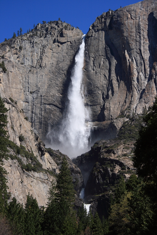
Yosemite Falls (mainly the Upper Yosemite Falls, but you can see part of Lower Yosemite Falls):

Yosemite Falls


The number of posts this year has been below the historical norm thanks to the absurd number of things going on.  Last week we took a break from our crazy lives to go visit our families back east.  We spent the first half in South Florida where my parents threw us an Engagement Party.  This let L’ meet a lot of the Florida contingent, me to see people I haven’t seen in years, and for us to see what pounds of tuna fish really look like.  Dad and and Shayo took photos of the event and they are posted in the album.  I apologize in advance if I misspelled anyone’s name or left out a caption (please let me know of any errors so I can correct them).

Thanks to Mom & Dad for honoring us:

 http://www.sanjoseabrams.com/photos/EngagementParty/

We’ve had lots of days with near record highs and sunny weather recently.  It’s a perfect time to call our relatives in the frigid northeast and enjoy ourselves outside.  We went back to Almaden Quicksilver Park in San Jose for a few hours.  Overly ambitious at the start, we had planned on a 6 mile loop.  That would have been possible except for the steep uphill climb at the beginning of the trail that lasted a good half an hour.  We still saw interesting remnants of the old mining days which was our main goal.  Photos from the hike are here:

http://www.sanjoseabrams.com/photos/AlmadenQuicksilverJan2009/

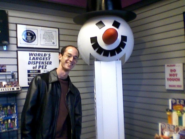
While we are busy with wedding planning, house hunting, and moving preparations, we still squeeze in some entertainment.   Long on my list of quirky local museums to visit was the Pez Museum in Burlingame, CA.   L’ indulged me with a stop there before heading to her school’s production of Peter Pan.  Here I am with the world’s largest Pez Dispenser:

Me at the Pez Museum

And speaking of house hunting, we spotted something I always suspected while driving between possible future residences: that Deer Crossing signs really do work:

Deer Crossing


All of the Hawaii trip logs are now online.  I’ve uploaded the photo album as well (one album for the whole trip).  

You can use this post as a table of contents to jump to the photos or  trip report from a specific day.

 Day 1:  Rainbow Connection.  

 Trip Log

 Photos


 Day 2: Ring of Fire

 Trip Log

 Photos


Day 3: Rocket ManDay 3: Rocket Man

Trip Log

Photos


Day 4: Here comes the sunDay 4: Here comes the sun

Trip Log

Photos


Day 5: Hawaii Five-ODay 5:  Hawaii Five-O

Trip Log

Photos


Day 6:  Don't go chasing waterfallsDay 6:  Don’t go chasing waterfalls

Trip Log

Photos


Day 7:  Walking on the moon

Trip Log

Photos


Day 8: Walking in a winter wonderland

Trip Log

Photos


Day 9: Day 9:  Do you know the way to San Jose?

Trip Log

Photos


(Travel back to California; posted January 5th, 2009 from San Jose)

Today is mainly a travel day.  I get up before L’ which gives me time to do some last minute packing and check in with the family back east.  While I’m checking the news on the computer, L’ gradually moves around on the king bed until she is stretched diagonally across it.  She’s shorter than I am, yet somehow “needs” the whole bed (not to mention the whole blanket).  

We check out of the hotel, fill up the car, and get to the airport.  We have time to get a horribly over priced lunch at the airport ($15 for a tiny pizza, garden burger, and soda!?) so we’re not grumpy for the flight.  After our final agriculture screening, we board the flight to SFO (why would I have fruit with me?  Clearly, they don’t know me, unless rasinets are now officially considered fruit). 

Our fantastic Hawaii trip now becomes a cherished memory and our whirlwind, over booked lives resume all too soon.

Mahalo for reading about our adventure.

Jump to the Day 9 photos.

(Mauna Kea, posted on January 4th from San Jose)

Earlier in the week, a major storm went over the island causing rain, flooding, clouds, and snow atop the higher peaks of the island.  One of the things I wanted to do on the Big Island was to go to the summit of Mauna Kea.  Atop are the world famous observatories and some of the clearest skies on earth.  The drive to the top requires a four wheel drive car (and our clown car is not one of them) and only one rental car company allows you to go up to the top.  Guided tours are a fortune and with the recent weather, it’s not looking promising for going to the top anyway.

We awoke today surprised to see the sun so we make a go of at least the visitor center of Mauna Kea (located at 9000 feet elevation; the summit is just under 14,000).  Since we just drove from sea level to 9000 feet elevation in under two hours, we hang out at the visitor center and look at the exhibits for a bit while we acclimate.  We’ve also changed clothes since it’s gone from the 70s at the coast to about 50 degrees.  After we each have a hot chocolate, we inform the visitor center that we’re going to start a hike that goes up the mountain.  There is snow a couple thousand feet up.  We plan on hiking up to try and get there, but realize it may not be possible because of fatigue or changing weather.

In less than an hour, we’ve made it up past 10,000 feet and over a 1000 feet of elevation gain in 1.2 miles on the trail (moderately steep).  We see one of the old craters on the mountain along with a (clearly volcanic in origin) portable toilet.

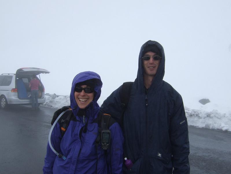
The fog starts rolling in, dramatically cutting visibility.  I’m getting a little tired and we’re at a path that leads (rather levelly) back to the road.  We make it to the road in a few minutes.  Minutes later, we wave at  a family in a pickup truck that is heading up the road and ask if we can get a lift.  They say “sure” and we hop in the back.  The drive takes us to over 11,000 feet of elevation after several miles (note, the hike is much steeper than the road).  The road all the way to the summit is still closed, but we’re at the parking area at the road closure where there are lots of cars parked and people playing in the snow.  Now in full winter gear (hat, gloves, rain jacket), we walk in the snow and take traditional Hawaiian photos of us in the snow.   It’s fun to see Hawaiians shoveling snow into the backs of their trucks to take home. 

After a little while at the top, someone offers to drive us back to the visitor center.  It’s now raining a bit and we get rather wet.  As soon as we get back to the visitor center, I make a quick restroom stop and then go to the car to change clothes.  L’ gets a couple hot chocolates and makes it to the car right as I’m done changing.  L’ tells the folks in the visitor center that we made it back and she says that people remembered us as those crazy folks who set out a couple hours earlier.  After we’re both in warm, dry clothes, we head back to the hotel.  Not that many people come to Hawaii and have more hot chocolates to stay warm than umbrella drinks to stay cool.

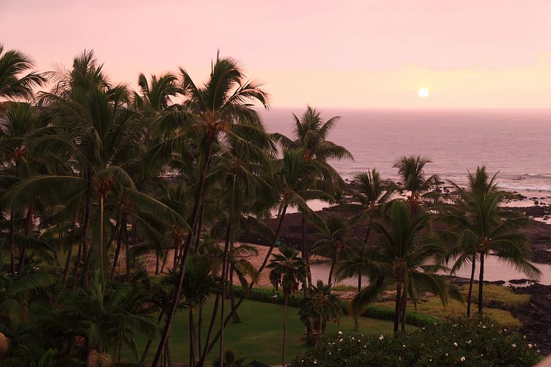
After much needed showers, it’s early enough to watch the sunset on our lanai in t-shirts.  Nothing like going from t-shirts to winter wear and back all within a few hours and a hundred miles.

After our recent dining adventures, I look up some places on yelp.  We call the top rated place to confirm it’s open and then head to Kona to eat there.  We find parking right away and have a great meal that doesn’t break the bank like a typical tourist town restaurant does.  We browse around Kona again and then return to our room.   It’s the first time in a long time I didn’t make it till midnight, but it was a fun day anyway.  Happy New Year to all and 2009 should be quite a ride.

Jump to the Day 8 photos.
(Kaloko-Honokohau posted on January 4th. 2009 from San Jose)

We slept in today.  L’ is a bit under the weather so while she went back to sleep, I wandered the hotel grounds looking at the Hawaiian ruins.  They’re not that spectacular, but I entertain myslef and also write up Day 5’s trip log.  L’ calls me when she’s up and then I return to the room to gather our stuff and head out.

It was warm, but overcast. Opting for a slightly less packed day, we head up the coast to just south of the airport and visit Kaloko-Honokohau National Historical Park. This one is hardly visited and our car is only the second one in the parking lot (we assume the first is for the National Park Ranger on staff). We pick up a pamphlet and map, L’ chats up the ranger as she normally does, and we head out.

We wander to the beach and learn about how the native Hawaiians made “fish traps”. The island lacks fresh water and arable land. To live off seafood, the natives used shallow pools near the ocean to grow and eat fish. The pools would fill up during high tide and then the fish would be stuck there in low tide. They also used pools of water to raise fish- an old time fish farm. 

We started walking along the beach and rested for a few minutes. I laid down on the sand and took a nice short nap while L’ finished part of my sandwich from earlier in the day. We continued on along the beach until we found the trail that heads back away from the ocean and towards the visitor center. Here’s where our relaxing day had a bit more exercise than planned.

There are two parallel paths back to the visitor center:  the first one that we took over the lava rocks and a second one further down that goes along a paved trail. Since we had already traversed the lava on our hike to the active flow on Day 2, I figured this would be a piece of cake (since it’s not raining and it’s daylight). We went for a bit along the “trail” and at some point we must have wandered off the trail and now were just going over the lava rocks. It’s a bit hard to describe, but this greatly slows down the pace as you need to make sure you step carefully, don’t twist your ankle, and don’t fall on the jagged rocks. 

After we go a bit and it’s clear we’re not on the trail, L’ suggests we turn back. I reply that it looks like we’re about halfway (since we can see the visitor center) so we press on. Of course, then the rocks get even trickier to traverse and instead of taking a ten minute walk along a paved trail, we end up taking about an hour until we finally reach the short path to the visitor center. This is one time when I suggest the crazier choice (in retrospect). My loyal readers will know that L’ normally suggests what mere mortals consider the crazier option. Just to set the scale, even she thought our trail was crazy.

Back at the visitor center, we return to our clown car and head back to the hotel for showers. Our dinner quest was another challenge of the day. 

Finding places to eat around Kona is difficult. We read about an Italian place down in Captain Cook (about twenty minutes south) that was recommended in Lonely Planet. We find it with no problem only to learn that they are closed for the week. I’m amazed that given what the economy is like, a business in a tourist town would close during one of the busiest weeks of the year. We head back and stop a little up the road at another recommended place. It’s open, but has over an hour wait. We’re already hungry and L’ recommends we stop at the neighborhood pizza type place in the strip mall a mile from the hotel. The food is mediocre but at least we’re no longer hungry. Then it’s back to the hotel for a well deserved umbrella drink and then some sleep.
 

Jump to the Day 7 photos.

(Kohala, Polulu Valley, and Waipi’o Lookout; published January 3rd, 2009 from San Jose)

Today we did a lot of driving, but saw some spectacular vistas. 

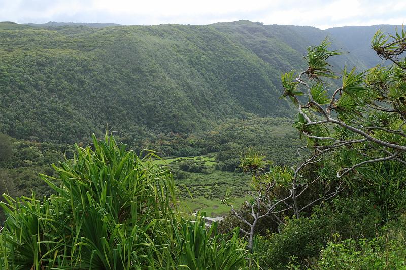
We started out by heading north to the region of the island known as Kohala (or as I kept calling it "koala").  The drive takes a while, but it was well worth it.  We head north and then veer east before we get to the ocean.  The road ends at Polulu Valley.  I park the clown car in the small parking lot, taking the last spot.  Lonely Planet describes the hike as the best short hike you can do on the island.   We start at the top which has a great view of the Valley below.  Unlike what normally happens, the views get better as we hike down.  While it’s not raining, the air is not especially clear; nonetheless, the vista is fantastic.  We do the hike down to the black sand beach below and I take lots of photos including attempts at  a few panoramas that I’ll try stitching at home.  We wander around the beach a little, then do the steep hike up quickly for some good cardio workout.

It’s around lunch time, so we return down the same road stopping in a small town.  We order our lunch which takes forever since they forgot our order.  Finally done, we head down what Lonely Planet describes as the best scenic drive on the island, Kohala Mountain Road (Hwy. 250).   It lives up to its name.  The green of the landscape is an amazing emerald green with picturesque cows grazing.  There are only a few turnouts for photo-ops, but we take advantage of them.

When the road meets up with the main highway again, we head towards the Waipi’o Valley Lookout.  The Waipi’o Valley is the next one past Polulu, but it takes a bit to get there.  We make it there by midafternoon.  It’s completely overcast and windy on the coast, but the view is still spectacular.  Some of the most amazing hiking is too be found around here, but it’s too late in the day to attempt it.  Too bad since there are supposedly spectacular waterfalls around here.  We walk part of the way down the 25% grade, 4×4 vehicle only road (it decends over 1000 feet in less than a mile).  After conferring on what we can do, we turn back since by then we’re running out of daylight.

We return to the car and head back to the hotel.  On our way back, we stop in Kona which is a touristy town with a bunch of restaurants.  We find one and it has good food and decent prices.  As a bonus, I get a great chocolate milkshake for dessert.  We then head back to the car and drive home for the usual showers and sleep.

Jump to the Day 6 photos.

« Previous PageNext Page »