This entry is likely one of my most anticipated entries since it’s about finally going camping with L’. It’s also a bit longer than my usual posts, but I’m sure my loyal fan club has built up their stamina. Feel free to pace yourself. If you want to skip to the photo album, scroll to the bottom of this entry.
Saying that L’ enjoys camping is like me saying that The Simpsons is just a tv show- it’s a gross understatement. While L’ has a shirt titled "Bed & Breakfast" with a picture of a sleeping bag and a skillet above a campfire, I normally think of camping like my Aunt does: a Holiday Inn without cable tv. I am definitely out of my element when it comes to camping.
We left the Bay Area Friday afternoon and headed to Strawberry, California. This gets us most of the way to our destination and breaks up the drive. Since we wanted to get going fairly quickly the following morning, I didn’t have time to look for any fields. The Strawberry Inn was a clean and comfortable stop for my last night on a regular mattress for two nights. After checking out of the hotel, we grabbed some snacks across the street and headed out.
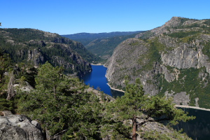 When people asked me where we were going camping, I either replied with "I don’t know", "The middle of nowhere", or "Somewhere in the Eastern Sierras". While all were correct, I now had a better idea of the destination having consulted the map. We were heading towards Bridgeport for lunch and then to the trailhead parking area. En route, we stopped at some scenic overlooks such as the Donnell Overlook, Sonora Pass, and Leavitt Falls. These were all very scenic and broke up the morning drive.
We stopped for lunch in Bridgeport (a small town off US-395) and then picked up our permits at the ranger station a short distance away. I learned that if you want to spend the night in the wilderness, you’ve got to sign up because they limit the number of people in the area. Theoretically, a ranger could ask you for your permit while you’re out in the wilderness, but this didn’t happen for us. I found it disturbing that the rangers at the station were on a first name basis with L’. I get food around the corner from home every week and they don’t remember me. More evidence that L’ is one of a kind (and nuts).
I only had a few concerns about the whole backpacking thing: wearing a heavy pack that strains my back, adjusting to the altitude, sleeping on the hard ground, and pooping without the benefit of 19th century indoor plumbing. As the story develops, you’ll see how these come into play.
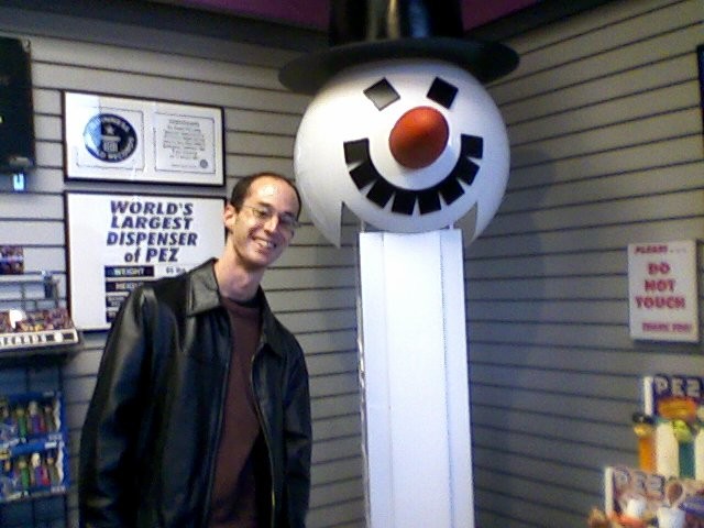
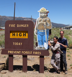 With permits in hand and a photo taken with a bear, we drove to the trail. Where we parked was at about 8000 feet of elevation. The area we were heading to to set up camp is at about 9000 feet and 3 miles in from the trailhead. We unloaded all of our stuff from the car and L’ hid some extra things in a bear can away from the car. There are these containers that are bear proof for storing anything with a scent. To avoid a bear ripping the the door of the car, it’s wise to not leave the bear can inside the car or trunk. It was now early afternoon and we were ready to go.
L’ took care of packing the backpacks. We borrowed one for me (thanks GG) while L’ chose one for herself from her extensive collection. As I was unloading them from the trunk, I was amazed at the weight of L”s backpack. Before going on the trip, I had said to L’ that I’ll go camping, but she gets to carry all the heavy stuff. I had no idea there was this much stuff and I was impressed she could hike with her pack on. (Some have commented that letting her carry the heavy stuff is not "macho" or that I should show off my strength and carry lots of stuff. To those people I say- "What’s wrong with you?" and "Enjoy your hernia. "). With everything ready to go, we waived goodbye to the car and hit the trail.
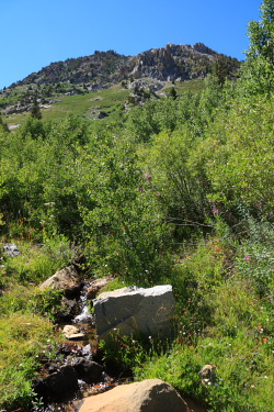 We were on our way up. I could tell that we were not at sea level, but was doing okay. L’ is much more used to the altitude and carrying a backpack. After we had gone for a bit, I needed to stop. My back was uncomfortable and I was getting hot. L’ took a look at my pack and made some adjustments. This shifted the weight towards my hips (where it is supposed to be) and off my back. I was now much more comfortable. I had some snacks on the way up, but since I was a little stressed about the whole weekend, I wasn’t excessively hungry. After periodic stops on the hike up and lots of photos, we made it to the area where we wanted to set up the tent. L’ had been here before and had already selected our spot. We lucked out that no one else had already taken it.
We proceeded to setup the tent which is pretty easy. We unloaded some stuff inside that we would not need now. It was getting later in the day so it was time for dinner. We pumped water from the lake (the pump filters the water for drinking) and began cooking. Since as soon as the sun goes behind the mountain it begins to cool off quickly, we wanted to be sure we’d be done with dinner and in the tent as close to sunset as possible.
As I got comfy in my sleeping bag, I was glad that it was not that cold out. I didn’t even zip up the sleeping bag most of the way until the middle of the night. It was windy so I popped in ear plugs so I could sleep. When nature called in the middle of the night, I was surprised how bright it was out from just star light (it was right around a new moon) and how much colder it had gotten from when we went to sleep.
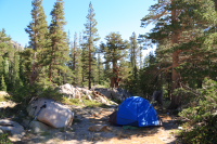 I slept okay, but as expected, it’s not the most comfortable accommodations for your back. By mid morning we got up and started breakfast. I had my usual cheerios while L’ made her coffee and hot cereal. Today we were planning on doing a day hike to West Lake. Since L’ didn’t think taking me from sea level to 9000 feet in less than 24 hours was enough, we were going hiking today that would take us to nearly 10,000 feet. I begin to wonder if, contrary to her claims, maybe she was trying to kill me? I was feeling a little better at the altitude but still wasn’t that hungry. Fortunately, my very slight headache from the previous night was gone.
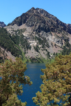 After breakfast, we packed up things for the day and headed out. It was again sunny and pleasant. I was feeling the altitude a bit more on this hike. It’s "only one mile" as L’ would say, but uphill and a decent workout for us normal folks. We figured out that my water pack was the issue behind some of my discomfort since it was limiting how much water I could suck down. Because the valve was malfunctioning, it was causing me to suck in air a lot of the time which is rather unpleasant. After fixing that, I downed a whole bunch of water and felt a lot better. It’s incredibly dry here and you’ve got to drink mind boggling amounts of water.
We made it to West Lake, coming very close to 10,000 feet in altitude during the hike. The lake was pretty and we had some lunch, wandered a bit and then headed back to camp to make dinner. I was feeling much better and we dined on some macaroni and cheese and our secret stash of wine. We again went to sleep shortly after sunset.
The second night was much cooler, but I was still warm enough in my sleeping bag. It was again windy, but I slept okay. It’s not exactly my new plush mattress, but I could still walk upright in the morning so it couldn’t have been too bad on the back.
This morning we had our breakfast and packed everything up. After taking a few last photos, we started the hike down that would take us back to the car. While the packs were slightly lighter now since we had less food, going downhill was the main cause of a much easier hike. We made it down in about an hour and a half (more than twice the pace of our ascent along the same trail). When we got to the car, we saw a few guys who we saw hiking up a few days ago. They graciously offered us some beer. L’ was driving so she declined, but I was happy to accept and surprised that these guys were able to keep beer cold in their car for two days (and proving that L’ has at least one thing to improve on next time). I figured a celebratory drink was well deserved after two nights in a tent. We loaded up the car and returned to civilization.
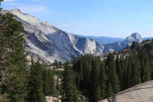 Since I had yet to make it to Yosemite after living in California for 9 years, L’ opted for the return route that would take us through the park. We made a few stops before getting to Yosemite- the RV park for a bathroom stop (ahh, indoor plumbing!) and a 5 minute timed shower, Mono Lake for a photo op, and the Mobil Station for lunch in Lee Vining. Yes, the gas station has this great restaurant next to it. It was good to be clean, sitting down, and eating well. After lunch, we drove through Yosemite making several stops including
http://www.sanjoseabrams.com/photos/BackpackingAug2008/
P. S. (Warning- body function alert; squeamish readers stop now). Astute readers will now know how my initial concerns about camping came into play during the adventure, with the exception of pooping in the woods. While not nearly as convenient as the loo, it wasn’t too much of an issue. And while MW said I should enjoy the great view compared with a normal lavatory, I don’t multitask well enough. And to Maverick, the bears now have their answer, and it’s a "yes!".
![yosemite2010_044[1] yosemite2010_044[1]](https://sanjoseabrams.com/blog/wp-content/uploads/2010/05/yosemite2010_0441.jpg) The drive to the park was uneventful. Since we left early enough in the day and took advantage of the carpool lane when available, we had few slow downs. We stopped for dinner in Merced. Merced is home to the newest UC campus (that’s University of California) and it has a quaint downtown. We strolled the main street to stretch our legs and found what looked like a nice place for dinner. All was fine, until it had been fifteen minutes and we still hadn’t ordered. All told, the food was good, but it took almost an hour and a half for a two course meal. That’s slow, even on my scale. So much for avoiding all the mountain driving at night. Despite it getting dark, the remaining drive to the park was smooth and we arrived at a reasonable time and then went to sleep.
The drive to the park was uneventful. Since we left early enough in the day and took advantage of the carpool lane when available, we had few slow downs. We stopped for dinner in Merced. Merced is home to the newest UC campus (that’s University of California) and it has a quaint downtown. We strolled the main street to stretch our legs and found what looked like a nice place for dinner. All was fine, until it had been fifteen minutes and we still hadn’t ordered. All told, the food was good, but it took almost an hour and a half for a two course meal. That’s slow, even on my scale. So much for avoiding all the mountain driving at night. Despite it getting dark, the remaining drive to the park was smooth and we arrived at a reasonable time and then went to sleep. ![yosemite2010_078[1] yosemite2010_078[1]](https://sanjoseabrams.com/blog/wp-content/uploads/2010/05/yosemite2010_0781.jpg) e Falls. It’s 3.5 miles (each way) with about 2700 feet of elevation gain. I wasn’t sure if I was up for this, but L’ said it was well graded and we did have all day. It turns out, that while it is well graded, there are a couple caveats to this. First, it’s not just a dirt path- it’s a bit rocky in places. Second, because we’ve had a wet winter, there was snow on the ground as we got towards the top. In any event, we made it to the top after about four hours (including numerous photo and snack stops). The view down the valley is good from the top and it was fun to see the snow. They really do need to put in an ice cream stand at the top. We hung out a bit to rest and the weather was pleasant.
e Falls. It’s 3.5 miles (each way) with about 2700 feet of elevation gain. I wasn’t sure if I was up for this, but L’ said it was well graded and we did have all day. It turns out, that while it is well graded, there are a couple caveats to this. First, it’s not just a dirt path- it’s a bit rocky in places. Second, because we’ve had a wet winter, there was snow on the ground as we got towards the top. In any event, we made it to the top after about four hours (including numerous photo and snack stops). The view down the valley is good from the top and it was fun to see the snow. They really do need to put in an ice cream stand at the top. We hung out a bit to rest and the weather was pleasant. ![yosemite2010_179[1] yosemite2010_179[1]](https://sanjoseabrams.com/blog/wp-content/uploads/2010/05/yosemite2010_1791.jpg) The hike down, as usual, was faster and we made it back to our room in time for quick showers and to clean up. We had dinner reservations at the restaurant in the Ahwahnee Hotel. We caught one of the shuttle buses from our hotel and arrived in time for dinner. The hotel is spectacular and worth a visit if you are in the park. The dining room was magnificent with huge windows and a piano guy at the entrance. The food was good, too, although we couldn’t really tell that it was that much better than the restaurant by Yosemite Lodge (although it has higher prices). Still, it was an experience to do once and we enjoyed it. By the end of dinner, we were tired, so we went back to our room and quickly fell asleep.
The hike down, as usual, was faster and we made it back to our room in time for quick showers and to clean up. We had dinner reservations at the restaurant in the Ahwahnee Hotel. We caught one of the shuttle buses from our hotel and arrived in time for dinner. The hotel is spectacular and worth a visit if you are in the park. The dining room was magnificent with huge windows and a piano guy at the entrance. The food was good, too, although we couldn’t really tell that it was that much better than the restaurant by Yosemite Lodge (although it has higher prices). Still, it was an experience to do once and we enjoyed it. By the end of dinner, we were tired, so we went back to our room and quickly fell asleep.![yosemite2010_238[1] yosemite2010_238[1]](https://sanjoseabrams.com/blog/wp-content/uploads/2010/05/yosemite2010_2381.jpg) ing, This is something I had not done before (it’s not a big activity back in Florida). After checking out of the hotel and loading up the car, we drove towards where highway 120 is closed in the winter. There’s the start of a short trail that goes to a giant sequoia grove (the Mariposa Grove of Giant Sequoias). We put on the snow shoes at the start of the trail and head out. The snow shoes make walking in the snow nice and easy and you really do feel anchored in. It’s not like regular walking, but once you get in the groove, you can move about as quickly.
ing, This is something I had not done before (it’s not a big activity back in Florida). After checking out of the hotel and loading up the car, we drove towards where highway 120 is closed in the winter. There’s the start of a short trail that goes to a giant sequoia grove (the Mariposa Grove of Giant Sequoias). We put on the snow shoes at the start of the trail and head out. The snow shoes make walking in the snow nice and easy and you really do feel anchored in. It’s not like regular walking, but once you get in the groove, you can move about as quickly. ![pinnacles001[1] pinnacles001[1]](https://sanjoseabrams.com/blog/wp-content/uploads/2010/03/pinnacles0011.jpg)
![pinnacles052[1] pinnacles052[1]](https://sanjoseabrams.com/blog/wp-content/uploads/2010/03/pinnacles0521.jpg)
