Travel


Again this year we decided to go to Yosemite in the spring.  April has the advantage of reduced crowds and traffic, with enough daylight to enjoy exploring the park.  This year it also marked us surviving two cross country flights in the last couple weeks.  After this weekend, we are looking forward to not getting on a plane or any long drives for awhile.

yosemite2010_044[1]The drive to the park was uneventful.  Since we left early enough in the day and took advantage of the carpool lane when available, we had few slow downs.  We stopped for dinner in Merced.  Merced is home to the newest UC campus (thatā€™s University of California) and it has a quaint downtown.  We strolled the main street to stretch our legs and found what looked like a nice place for dinner.  All was fine, until it had been fifteen minutes and we still hadnā€™t ordered.  All told, the food was good, but it took almost an hour and a half for a two course meal.  Thatā€™s slow, even on my scale.   So much for avoiding all the mountain driving at night.  Despite it getting dark, the remaining drive to the park was smooth and we arrived at a reasonable time and then went to sleep.

After our included breakfast at the cafeteria (Mmmm, cocoa-puffs), we ā€œgeared upā€ and were on our way.   We decided on hiking to the top of Yosemityosemite2010_078[1]e Falls.   Itā€™s 3.5 miles (each way) with about 2700 feet of elevation gain.  I wasnā€™t sure if I was up for this, but Lā€™ said it was well graded and we did have all day.   It turns out, that while  it is well graded, there are a couple caveats to this.   First, itā€™s not just a dirt path- itā€™s a bit rocky in places.  Second, because weā€™ve had a wet winter, there was snow on the ground as we got towards the top.    In any event, we made it to the top after about four hours (including numerous photo and snack stops).   The view down the valley is good from the top and it was fun to see the snow.  They really do need to put in an ice cream stand at the top.  We hung out a bit to rest and the weather was pleasant.  

yosemite2010_179[1] The hike down, as usual, was faster and we made it back to our room in time for quick showers and to clean up.  We had dinner reservations at the restaurant in the Ahwahnee Hotel.  We caught one of the shuttle buses from our hotel and arrived in time for dinner.  The hotel is spectacular and worth a visit if you are in the park.  The dining room was magnificent with huge windows and a piano guy at the entrance.  The food was good, too, although we couldnā€™t really tell that it was that much better than the restaurant by Yosemite Lodge (although it has higher prices).   Still, it was an experience to do once and we enjoyed it.  By the end of dinner, we were tired, so we went back to our room and quickly fell asleep.

Opting for a different activity on Sunday, we went snow shoeyosemite2010_238[1]ing,  This is something I had not done before (itā€™s not a big activity back in Florida).   After checking out of the hotel and loading up the car, we drove towards where highway 120 is closed in the winter.  Thereā€™s the start of a short trail that goes to a giant sequoia grove (the Mariposa Grove of Giant Sequoias).  We put on the snow shoes at the start of the trail  and head out.  The snow shoes make walking in the snow nice and easy and you  really do feel anchored in.  Itā€™s not like regular walking, but once you get in the groove, you can move about as quickly. 

The trail starts off downhill and winds around through the trees for a mile or so.  We then get to the nature trail where there are some signs about the trees.  Itā€™s very pretty with all the snow out and the itā€™s warm enough that for the walk back, weā€™re only in our t-shirts.  Getting back to the car, we let the shoes dry off and put on new socks so weā€™re nice and comfy for the drive back, which is uneventful.  We pick up our usual pizza pie at home to end a fun weekend in Yosemite.

All the photos are here (note that there are five panoramas which are indicated in the captions, along with links):

http://www.sanjoseabrams.com/photos/YosemiteApril2010/index.html

It had been awhile since we went away for the weekend and were getting a little antsy.  We squeezed in a night away last weekend to head a couple hours south.   On tap this time was a night in Salinas and a visit to Pinnacles National Monument.

We had last been to Pinnacles a couple years ago during a rare cool Memorial Day Weekend (staying in San Juan Bautista).  Pinnacles can be brutally hot in the summer, so springtime is usually the best time to go.  March and April is also wildflower/allergy season.  We were hoping for good weather and lots of flowers and we lucked out on both fronts.

There was little traffic heading down to Salinas on Friday night.  Salinas is not even a couple hours drive and with the carpool lane, it was an easy drive.  We checked in to our hotel and headed to ā€œOld Townā€ Salinas where there were a few restaurants recommended by Lonely Planet.  Not having a local map, we just continued on the highway and immediately after getting on 101, saw a sign for Old Town at the next exit.  We easily found the area and also the Steinbeck Center that weā€™d stop at tomorrow.

Old Town was quaint.  Some of the buildings date back around a 100 years to when the Salinas Valley was first starting out.  When the Dust Bowl hit the Plains, people headed West in search of a better life (and better soil).  Salinas now calls itself the ā€œSalad Bowl of the Worldā€ for all of the agriculture that is grown here.  It is a several billion dollar a year industry in the area.  Iā€™m amazed that, as big as that is, itā€™s roughly on par with the annual revenue of my company (which employs far fewer people).

pinnacles001[1] Saturday morning we enjoy the included breakfast in the hotel and then go to the National  Steinbeck Center.  John lived in Salinas, hence the museum.   The museum was mostly devoid of visitors.  The exhibits were well done.  It was like confronting all of those horrible high school English reading assignments in museum form.  JS was an interesting character- aside from writing, he travelled across the country, took a cruise of Baja California, and was even a war reporter during WWII. 

Heading out from the museum, we drove towards Pinnacles National Monument, stopping en route for a quick lunch.  The road into Pinnacles on the west side is a one lane road, which was interesting the few times another car would be coming.  Itā€™s really wide enough for both cars, but I generally prefer my own lane. 

pinnacles052[1] We both agreed that the west side of the park was prettier than the east side that we visited the last time.  The flowers were out in full force and the rock formations were easier to appreciate than the last time when it was raining.  I did my usual duty of slowing down the hiking pace by taking lots of photos.  The hike was up about 1200 feet of elevation in around 1.8miles and a total loop of around 4.5 milesā€“ a nice workout.

We made it back to the car and hit the road back home.  As we did on previous road trips, we called in a pizza and picked it up on the way home.  Amazing how just 36 hours away from home really can feel like a vacation.

The full photos are here:

http://sanjoseabrams.com/photos/PinnaclesMar2010/

After two days in Los Angeles, it was time to say goodbye to L”s friends and Tinseltown. We were off to the Anza-Borrego Desert, a few hours drive. I had never heard of Anza-Borrego, but L’, who has already hiked in Death Valley, wanted to visit another desert socal117[1]park. The drive out was uneventful and we got to the park’s visitor center by mid afternoon to get some hiking suggestions and pick up a map. We then checked into the hotel and returned to the park for a hike to a set of palm trees and oasis (the Palm Canyon trail).  It’s about 3 miles round trip and we finish just as it’s getting dark. It’s neat to see water and palm trees in the middle of the desert. After the hike we return to the hotel for showers and dinner at the adjacent restaurant.

We now have one full day to explore the park. The park is huge (the largest California state park and the second largest in the lower 48 states) so we use our guidebooks to find some things of interest that aren’t too far away. We visit three trails to see Native American pictographs, morteros (holes the Native Americans bore into the rocks to grind up plants), and the Marshall South home. Each of these are moderately short hikes and we drive between them. L’ conveniently omitted telling me beforehand that to get to nearly all of the interesting hiking in Anza-Borrego, we would be driving on dirt roads. No wonder we took my car. The dirt roads, or as the map calls them "primitive roads", are in decent shape and you can easily go about 10mph. Except for getting filthy, the car survived unscathed.

socal154[1] Each of the hikes were interesting. The pictographs show that human activity has been present here for a long time, well before Europeans came. The moreteros and remains of the Native American village show more human presence in the desert. The South’s home shows what an eccentric (that is, nutcase) can do if they really want to (a family lived in the desert without utilities in the 1930s for 15 years).

After all the hikes we drive back to the hotel and do some online research to find a place for dinner. Many places are closed for Christmas, so we struggle to find something. We finally do and then figure out that the address we have is out of date. After much longer than it should have been, we find the place and have dinner before heading home to go to sleep.

On our way out of the park, we do a short hike at the Earth Narrows trail. It’s a narrow canyon type thing that would be more interesting if I were geologist. There are different types of rock as we walk and the change between types is obvious; however, we don’t really know why this is significant or why we should care.

socal287[1] We then head out from the park towards the town of Julian, California. It’s a town that dates to the mid 1800s and we’re surprised how many people are walking around the downtown area. We find a lunch place, wander the town for a little while picking up some candy, and then go for a hike at nearby William Heise County Park. We then start the drive home making it past Bakersfield for the night and finish up the drive the following morning to conclude our fun road trip to Southern California.

The full photo album is here:

http://sanjoseabrams.com/photos/SouthernCaliforniaDec2009/index.html

As my friends may know, I’m a bit of a Simpsons fan. A few years ago, Universal Studios opened "The Simpsons Ride" and I’ve been wanting to go. The main reason for stopping in L.A. was for me to make my pilgrimage to the attraction. After breakfast, we went to Universal. I hadn’t been there since I was a kid.  After it took way too long to get our tickets, we entered the park.  We stopped by a couple rides and shows and then had lunch. By then, the wait times (as nicely indicated on the electronic sign) showed a reasonable wait time of about 20 minutes for The Simpsons Ride, so we hit the line.


socal069[1]

The waiting area is well done with clever posters and new and old clips of the show. All the amusement parks do a good job of entertaining you while you are waiting (so you don’t feel like you’re on "The Line Ride"). The ride is done up as a visit to "Krustyland". It’s a motion simulator ride like "Star Tours" was years ago. They improved things a bit by making it more immersive by having the screen be nearly 360 degrees (think IMAX type). The "plot" is that Sideshow Bob is trying to kill the Simpsons at Krustyland. It had cute tie ins to the show and I liked how you were going though Krustyland and the town. All in all, I was entertained and my mission was complete.


socal074[1] Afterwards, we hit a couple more rides and got our picture with Marge & Homer. Before we left on vacation, I had the idea to get a picture with L’ on one side, Marge on the other, and me in the middle receiving a kiss on the cheek from each of them. Lacking the guts to actually set it up, L’ stepped up to the plate and asked Marge & Homer. Marge actually did it and L’ was ready, only the camera guy didn’t take the picture. Then Homer played along and looked upset, turned his back to which Marge consoled him. He then kissed her hand and made up. It was very cute and in the end we just got a picture of the four of us.

The studio tour tram ride was neat, but I recall it being better when I was there as a wee-one.  Now the tour feels much more like an amusement park attraction than an actual visit to a movie studio.  The only thing really movie related was seeing the set from Back to the Future and (my favorite show) Desperate Housewives.   There was a cool set of an airplane crash, but other than the sets, there was very little movie related.   Lā€™ and I agreed that the place is fun as an adult but really magical as a kid.

After hitting the remaining attractions of interest, it was dark and we were getting hungry so we hit a restaurant adjacent to the park.  Since we had a somewhat early dinner, it was still early enough that we made a go of getting to the Griffith Observatory.  It was then that we got stuck in the infamous LA traffic. It turned out that the park the observatory is located in was home to a light show and there were tons of cars going there. We call the Observatory to find out what the deal was and were surprised when an actual person picked up. The guy was awesome and we described where we were and the traffic backup, to which he looked on a map and gave us complete directions to sidestep the jam and we make it to the Observatory. The museum there (famous for being in the movie "Rebel Without a Cause") was small but informative and the views of the city were great. From here, we headed home and went to sleep.

socal099[1]

The full photo album is here:

http://sanjoseabrams.com/photos/SouthernCaliforniaDec2009/index.html

We had been discussing taking a short vacation for awhile and finally on Saturday sorted out the details. After living in California for 10 years, I was finally off to visit our neighbors to the south- we were heading to L.A. We left Monday in the early evening to drive most of the way at night (since I-5 is an efficient, yet boring road). We made it past Bakersfield and were within about an hour of our destination by the time we grabbed a hotel for the night.

Waking up on Tuesday, we enjoyed our included breakfast at the hotel. While watching the news, we hear that the Grapevine is snowed in and that I-5 is closed. (The Grapevine is the name for the mountain pass that we need to go through to get to L.A.). Fortunately as we finish breakfast, the news reports that the road is open and we decide to just go for it. We luck out in that there is no traffic and a scenic snow dusting on the ground makes for a pretty drive.

socal001[1]


We arrive at the Getty Center around 10:30am and are surprised how crowded it is. I’ve been wanting to go to the Getty for awhile. The architecture is interesting as is the art collection. It’s a lot bigger than I was expecting and we spend most of the day there. Mr. socal021[1]Getty made his money in the oil business and then died and left his estate to from the center. It’s now one of the richest art institutions in the world with several billion dollars in endowment. As my dad would say "you can do a lot on an unlimited budget". There aren’t that many superstar paintings, but it certainly is a worthy museum.


L’ connects with her friends that we’re staying with and we plan to meet for dinner. We get to the deli early which allows us to get some items at the nearby store. It was nice to finally talk with L”s friend and to meet her husband & kids who did not attend the wedding. We’re beat by the time dinner finishes and follow them back home to get some rest for the big day that follows.


The full photo album is here:

http://sanjoseabrams.com/photos/SouthernCaliforniaDec2009/index.html

We decided to head out of town for a weekend in October. Not wanting to spend too much time getting to our destination and also wanting some decent weather, we decided to head down to the Monterey Peninsula. We were originally thinking of going to Mendocino, but rain was forecast there; we chose well since the weather in down south was spectacular.

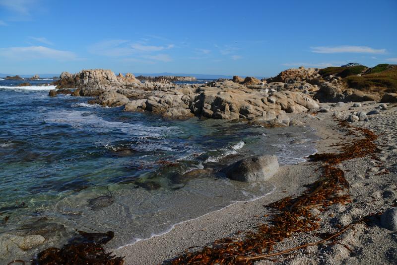
Leaving after work on Friday, we encountered just a little traffic. Making a french fry snack stop about half way there, we arrived at the hotel an hour or so before sunset. Our accommodations were in Pacific Grove which is adjacent to the ocean and the hotel was just a few minute walk to the water. After checking in, we walked to the beach and did a nice loop along the coast. It’s pretty at sunset and I scoped out some photo possibilities of the lighthouse in the event we’d be back there at dusk again (turns out, we weren’t).

Eventually making it to the restaurant for a late dinner, we enjoyed Passion Fish in downtown Pacific Grove. The food was excellent, service a little slow, but overall a good restaurant. We’re often disappointed that dining in our travels is not as good as what we get down the street from us, but that was not the case this time. We walked back to the hotel after dinner and slept well.

We started Saturday with breakfast (stale bagels) in the hotel. We then went back to the ocean near the hotel to take in the views. By mid-morning, I was already racking up the photos on the scenic coast. As I’ve said before, we are spoiled to have such beautiful scenery so close to home. After wandering the coast, we hit the 17-mile drive through Pebble Beach. It’s about $10 for the drive. We made various stops along the way, taking in the sites – coast, golf course, sea lions, birds, the Lone Cypress, future residences (why not take both $24M houses- it’s so hard to choose), and overall pretty scenery.

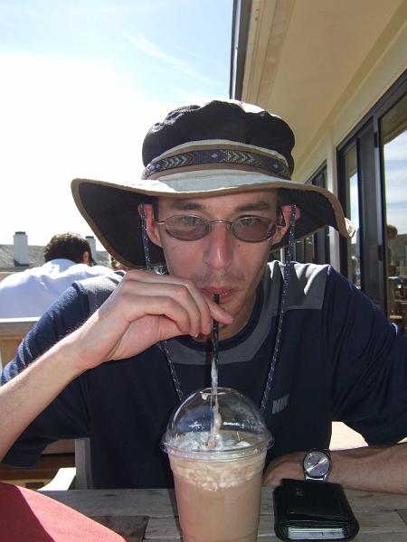
By early afternoon we were nearly done with the drive so we stopped at the Lodge for lunch. They have a nice restaurant overlooking the putting practice area and one of the tee off areas. Since the weather was spectacular (mid to upper 70s), we ate outside (added bonus- heckling golfers). Ā  The food was very good and not too expensive considering the location. Most importantly, I saved room for a $7 chocolate milkshake. To partially quote Pulp Fiction, it was a good milkshake.

Now properly hydrated and full, we exited Pebble Beach and returned to Highway 1 southbound. Aside from the scenic drive along the coast with a few photo stops, we headed to Julia Pfeiffer Burns State Park. The main attraction there is a waterfall that is right off of the ocean. It’s only a short hike to it and is neat to see. We wander around the park a little bit, but need to head back north to clean up in time for dinner in Carmel.

After an evening in Carmel, we returned there on Sunday. Our first stop is another California Mission, the Mission San Carlos Borromeo de Carmelo. Like most of the missions, it is mostly rebuilt and not original. Being the non-Jewish Sabbath, there is mass going on so we can’t just roam the inside in our t-shirts and transformer pants. We take a quick peak and wander the grounds, courtyard, and exhibits. We return to downtown Carmel and notice on the drive what our guide book had pointed out- there are no addresses in Carmel. The houses just have names and people navigate there by cross street. I suggest that we should start referring to our house in this way, but L’ is less than enthusiastic. We wander the galleries and shops of Carmel and get some lunch and snacks for later.

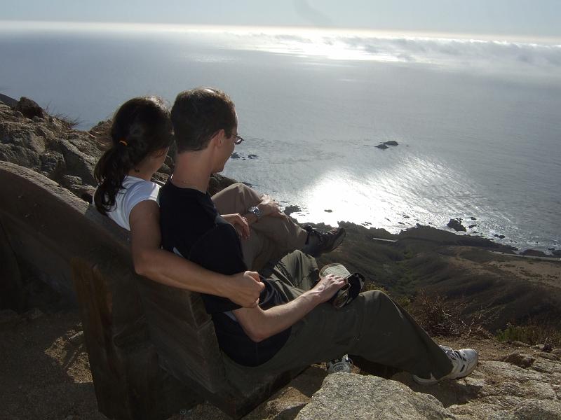
Leaving Carmel we again head south, this time towards Garrapata State Park. It’s a short drive and the weather is still sunny. The top of the trail has a view of the ocean. We start hiking and there are minimal signs and no paper maps available. It’s a straightforward loop so we just start going. After winding up at a river instead of ascending, we back track and find the unmarked fork in the trail that we had missed earlier. Now we go up, and up, and up and up. It’s very steep (20-30% grade, I found out later) and the traction is poor. It’s a struggle, but we make it to the top. The view is good, but not worth the effort to get there, in my opinion. It’s about an hour past when we had planned to head home, but we finally are back in the car and on our way. We pick up pizza once we get home and are just glad to have had a fun weekend out of town.

View all the photos from the weekend:

http://www.sanjoseabrams.com/photos/MontereyOct2009/index.html

All of the Alaska Trip Reports and photos are online.Ā  As I’ve done recently, the photos are all in one album.Ā  You can use the links below to jump to a particular section.

SFO to DenaliSan Francisco to Denali

Trip Report

Photos


DenaliDenali National Park

Trip Report

Photos


Denali to Setting Sail

Trip Report

Photos


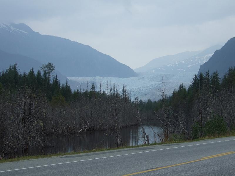
Glacier Bay

Trip Report

Photos


Skagway

Trip Report

Photos


Juneau

Trip Report

Photos


Ketchikan

Trip Report

Photos


Cruising to Canada

Trip Report

Photos


Vancouver

Trip Report

Photos


It cost more than a night’s hotel stay to fly back on Monday so we stayed a night in Vancouver and returned home on Tuesday.  Most hotels were all the same price so we picked what seemed like the nicest of the bunch.  When we asked someone in the cruise ship terminal where the hotel was located, they said "you’re here- just take the elevator upstairs".  We couldn’t have done better if we actually tried and it couldn’t have been easier.

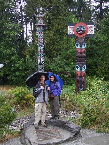
Unfortunately, the weather was not as well planned and it was raining.  We left the bags at the hotel and started walking along the waterfront towards Stanley Park.  We get to the park and there is a good view of the city.  We wait too long for the "every fifteen minutes" shuttle bus and ride it to the totem poles.  We take in the poles for a little bit, but it’s raining rather nicely at this point.

We’re getting hungry and waterlogged so we board the next shuttle and ride it as it loops around the park.  We get off at the entrance and start walking back towards the hotel.  We aim to walk through a portion of town that the concierge  recommended as a shopping area.  We find a  sushi place.  Lunch takes way too long (I know my chicken teriyaki needs to be cooked, but are they out fishing for L”s tuna roll?).  We go back to the hotel and get our room.  I watch a little tv and nap.  L’ gets bored after the first hour of my nap and goes exploring.  She returns after my 2nd napping hour and my shower.

We get an Italian restaurant recommendation in the gastown area.  Food was good and we wander around afterwards.  We run into the steam clock which was something I had wanted to see.  It was then back to the hotel for final packing.  We ran into a few people from our first night on the cruise in the hotel bar and chatted for a bit.  Finally, it was off to sleep. 

Of course on Tuesday it stopped raining.  We had breakfast and went to the airport.  Our honeymoon vacation was over and we returned to life in California as a married couple.

With our last day at sea, we relax while amusing ourselves with onboard activities.  In the mid morning there is a cooking demonstration and galley tour.   The tour was interesting.  It’s an amazing operation storing food for 3000 people for two weeks.  The ship loads up nearly all of the food in Vancouver and then just picks up some fish in Alaska.  At home, we can’t even make it a couple days without stopping at a grocery store.

In the early afternoon, there was a talk by the navigator about navigation in general and specifics to our ship.  It was okay, but not that informative.

The rest of the day was filled with eating (both of us), exercising at the gym (L’) ,and napping (me).  We packed up our luggage in time for pickup and then slept our final night at sea.  We would wake up in port and in another country.

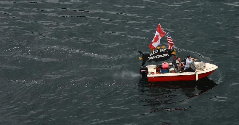
There was one unusual thing today and that was the Alert Bay Trumpeter.  The captain of our ship announced we would be entering Alert Bay (surely you’ve heard of it) and would be serenaded by the Alert Bay Trumpeter.  Not sure what to expect, I grabbed my jacket and camera and made my way to the top deck.  A small motor boat appeared alongside our ship and one of the two people on it began playing on a trumpet.  The ship would pass him and then he would head to the front of our ship as we sailed by him again.  Each time he played a different song.  It was corny and partly off key, but amusing in its absurdity.  He got a nice cheer from those on deck.
 

Our good fortune on the weather finally ran out- today it rained.   This isn’t surprising because Ketchikan gets 170 inches of rain per year (about ten times what we get back home). 
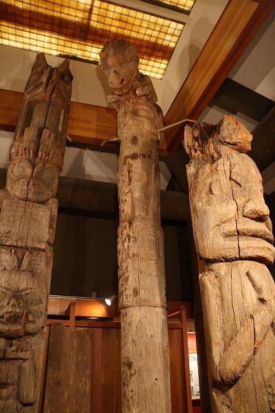
We get a map of town and head towards the Totem Heritage Center.  Native Alaskans carved enormous totems out of whole trees.  The climate and abandonment of native towns lead to totems throughout the state needing a place to be preserved.  As part of a public works project of the Great Depression, many totems were moved to Ketchikan and are at the museum.  Only a few are on display, but they are neat to see.  We see and learn about the different animals and symbols used from the museum’s well done displays.

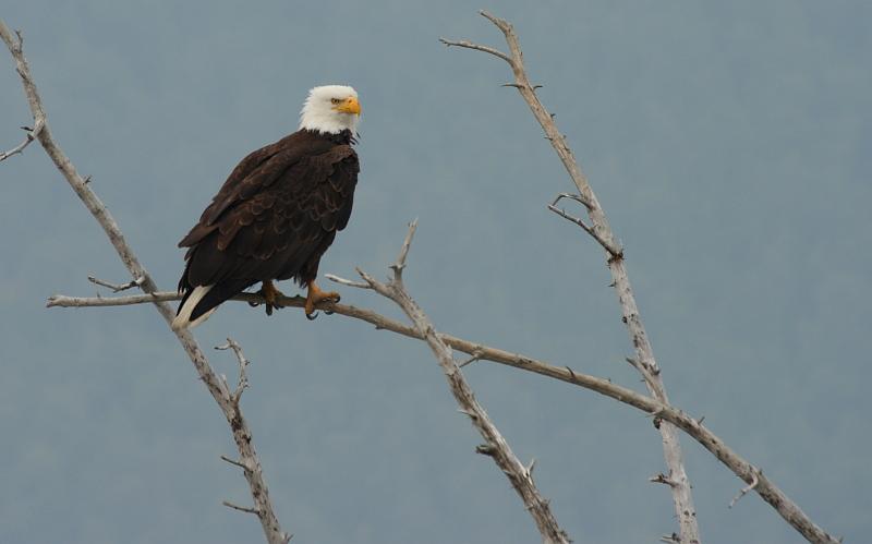
The Totem center is small and we then proceed to the bald eagle center and salmon hatchery next door.  The short guided tour is mediocre, but we do get to see a couple eagles up close.  While fun, it doesn’t compare to when we saw them in the wild a couple days ago.  It is, however, very nice to be out of the pouring rain.

We consult Lonely Planet and find a Mexican restaurant for lunch.  I’m not normally a fan of Mexican food, but L.P. says they have good fried chicken and their sign claims the town’s best pizza.  Our waiter from the cruise is coincidentally already eating at the place.  Since he hails from Mexico, we figure it will be good.  The food is good and by the end of lunch the rain has nearly stopped. 

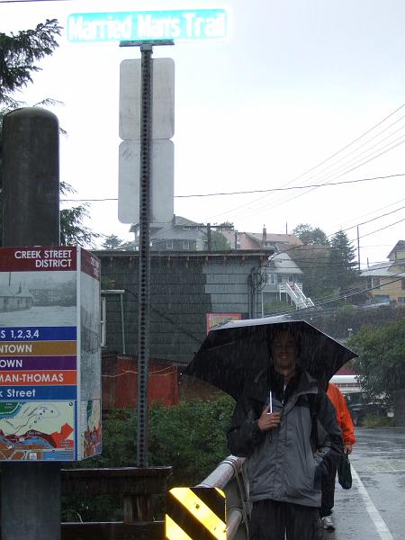
We wander down Creek Street, the city’s old red light district.  As they like to say, it’s where men and salmon go upstream to spawn.  When Ketchikan boomed for mining and fishing, it was male dominated so brothels did big business.  The town now survives on fishing and tourism.
 

I’m now sufficiently water logged and return to the ship to dry off, while L’ wanders to the town library for a quick internet check.  Soon we will depart on our day and a half trip to Vancouver.

« Previous PageNext Page »