Travel


We arrived late last night on our flight.  It’s so nice flying on a smaller plane and into a small airport.  It’s much less crazy.

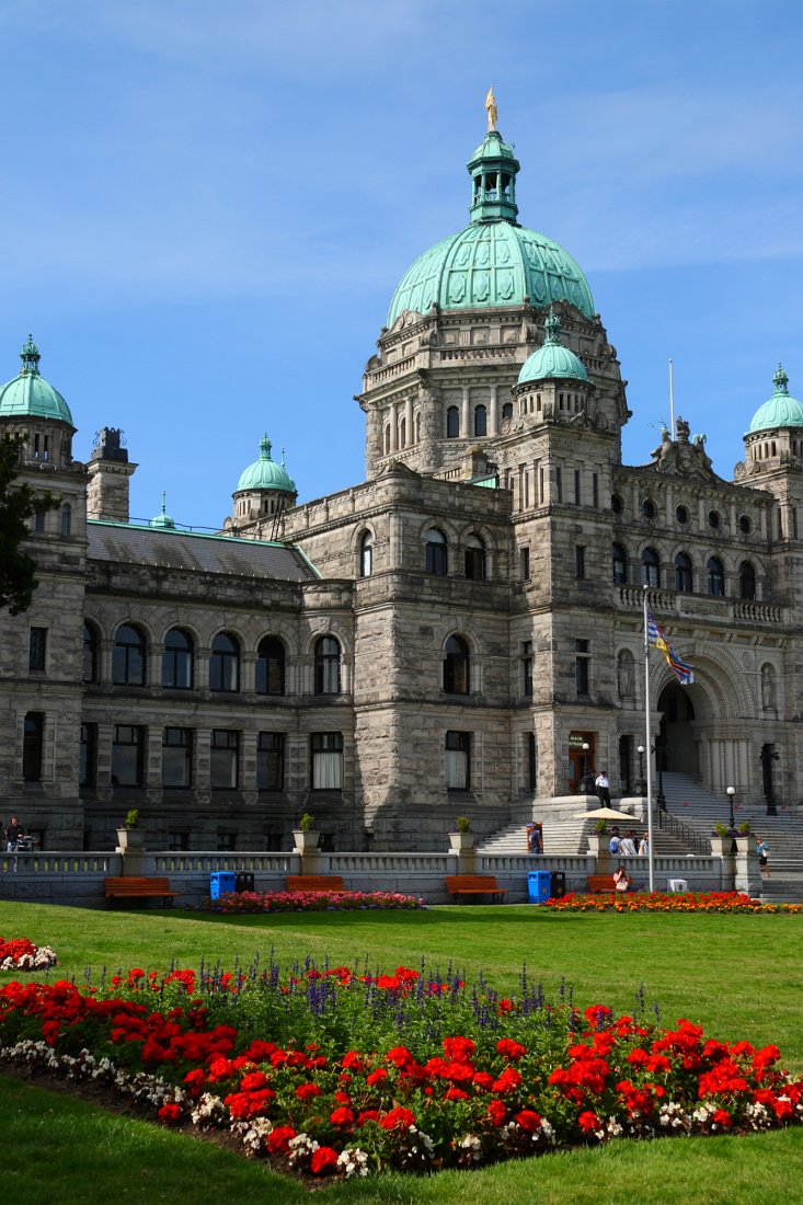
For our first day in Victoria, the capitol of British Columbia, we walked from our hotel down to the harbor.  It’s very scenic down there with a couple large ornate buildings adjacent to the water – the Empress Hotel and the Parliament Buildings.  We meet for a tour of the Parliament Buildings and are surprised that there is no fee and no security.   Granted, the government was not in session, but I can’t see this happening in the U.S.   The tour is interesting, but not being Canadian, not as meaningful to us Yanks. 

We head over to the nearby BC  Museum which is large and well done.  It has exhibits on the First Nations Peoples (the term Canada uses instead of Native Americans; I don’t know why they didn’t use Native Canadians).   We learn that Canada treated their natives about as well as we did down in the U.S.    We also check out the nearby Helmcken House (first occupied in 1852) and St. Ann’s Schoolhouse, another old building.

After all the touring, we browse through the Empress Hotel on our way back to the hotel for the all important nap.  Once we are rested, we head over to a nearby restaurant (Brasserie L’Ecole) that is highly recommended but does not take reservations.  We put our name on the waiting  list, wander nearby Chinatown and then return about when our table is ready.  Dinner is very good and we’re ready for our next day of the trip.

View all the trip photos here:

http://sanjoseabrams.com/photos/VancouverIslandAug2011/

For the long 4th of July weekend, we spent some time on the Central Coast.  After learning that Santa Barbara is a lot further than it seems like it should be, we settled on staying in Santa Maria, about an hour closer.  It’s a bit past San Luis Obispo that we visited a few years ago.  The central attraction in the area are the numerous wineries, but we squeezed in hiking and sightseeing as well.
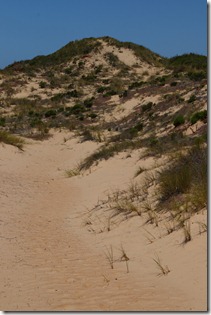
santamaria060On our first day, we headed towards the Oceano Dunes Recreational Area.  This is primarily an area for ATV’s, but there is a preserve adjacent that is vehicle free, protected, and open to hikers.  The dunes are upwards of 500 feet of sand, so this isn’t your ordinary beach.  It was more of a struggle to find the hiking zone than it should have been, but we made it in through a back way and were delighted with a nearly empty place.  Lots of sand and one of the more unique things to be hiking through.  The photos don’t do it justice.

After a lunch stop, we went to the town of Arroyo Grande for lunch and, more importantly, a stop at Doc Bernstein’s Ice Cream Lab.  Doc’s does have times when they design new flavors before your eyes, but today it was just a regular ice cream shop with phenomenal ice cream.  The oreo cookie mint ice cream was fantastic.   After ice cream, we did a short walking tour of the downtown area.

With full stomachs, we headed back towards Santa Maria to a winery (McKeon-Phillips) that was listed on the AAA winery map.  It was really a hole in the wall in an industrial section of town.  We were surprised that there were others there and that the wine was actually good.  After our wine tasting, we returned to the hotel for showers and then went for dinner. 
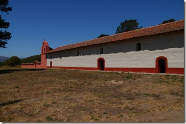
santamaria107On our second full day, we started at the La Purisima Mission State Historic Part, the location of another California Mission.  This one has an informative visitor center and we then tour the grounds and buildings.  The buildings were rebuilt in the 1930s by the Civilian Conservation Corp since the original ones were destroyed in an 1812 earthquake.

After a quick pizza lunch in the nearby town of Lompoc (surely you’ve heard of it), we head to a wine tasting room that is not too far away.  We enjoyed our wine at dinner last night and found that the winery was virtually on the way to our next stop.  And how could we not go to a winery called Flying Goat whose winemaker is also the “Chief Goat herder”? 
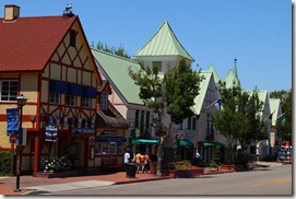
santamaria118Following wine tasting, we went to Solvang whose claim to fame is that it is a Danish town in the middle of California.  Being inland, it’s hot – 100 degrees.  As the clichĂ© goes, it’s a “dry heat”, but 100 is hot regardless.  We wander the streets (which feel like Epcot center) and then do a tour of another mission,  Mission Saint Ines.    This one is a mix of original and rebuilt, but is interesting nonetheless.  It was damaged in the same earthquake that destroyed the La Purisima Mission. 

Now that we are good and hot, I get a scoop of ice cream to cool off before we depart for some afternoon wine tasting.  This time we’re going on the Foxen Canyon trail of wineries. It’s getting late and the wineries close early so we only had time to stop at Fess Parker.  As Lionel Hutz used to say, you might remember him from such TV characters as Davy Crocket and Daniel Boone.  The wine here was also good. 

Stopping at the hotel to shower, we then go for dinner in Pismo Beach.  We finally had a really good meal on the trip as we dined at the Ventana Grill.  Service was a little slow, but the food was good and the fog cleared out for a spectacular ocean view. 
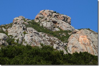
santamaria153For our last day, we started our way north with a stop in San Luis Obispo and a hike up Bishop’s Peak.  It was a well graded, moderately steep climb of 1000 feet over two miles.  The view from the top was good, but we are so used to hiking in cool weather, that the mid 70s and full sun felt hot. 

We have lunch in SLO and then make one final wine tasting stop on the way home.  L’ did some research and found a well rated winery on yelp.  Their website is quite entertaining so we figure we should check it out (my comment was that they must smoke a lot of good cork).  The bathroom at Le Cuvier Winery confirmed their funkiness. The wines are mostly unusual blends, but they also include food with the tasting and we enjoyed a few of the vintages. 

It’s now time to return home as the three day weekend comes to a close.  We had a fun time on the central coast and are returning home with our biggest haul from a wine region. 

See all the photos here:

http://sanjoseabrams.com/photos/SantaMariaJuly2011/
DSCF0261We travelled for an extended weekend to the East Coast for Maverick’s wedding in New Jersey.  We did some local sightseeing including the Thomas Edison National Historic Park and Eagle Rock Reservation.  After Maverick’s wedding, we went into New York City for some touring there.  We went to the Metropolitan Museum, the Lower East Side, and Lower Manhattan over a few days.   While it was hot and  humid, we enjoyed taking in the sites. 


Here are all the photos:

http://sanjoseabrams.com/photos/NewJerseyMay2011/

After yesterday’s long day of activity on the volcano, we took it easy today.  We found a beach recommended in the guidebook for some morning lounge time.  We read and relaxed until it was lunchtime.  It was a perfect Hawaii morning.

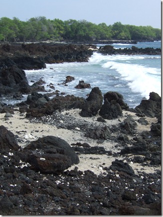
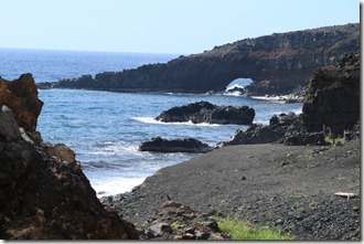
maui484After lunch, we moved on to Ahihi Kinau Natural Area Reserve to the south.  It’s mostly around old lava flows.  We do some walking on the easy trail and then take a short stop at the beach where I take a short snooze.  We then walk back to the start where there is some calm water for L’ to snorkel.  She returns quickly because the water was cloudy.

On the way back we make dinner reservations at the place we ate nearly a week ago on our first night on Maui.  Cafe O’lei had very good food, reasonable prices, and a great Mai Tai and we looked forward to dining there again.  We have an early dinner and then walk back to the hotel to pack up.  Tomorrow our vacation ends and we return to the mainland after a great trip.

View all the trip photos here:

http://sanjoseabrams.com/photos/MauiDecember2010/

The tallest peak on the island of Maui is the peak of the volcano, Haleakala.  The guide books recommend getting to the summit to watch the sunrise.  Even in Hawaii, the sunrise occurs early in the morning (can’t they reschedule it?).  We couldn’t muster a 4am wakeup, but got up at the still early time of 6am.  It took a little more than an maui409hour and a half to get to the summit.  We brought plenty of extra layers so we stayed warm at the summit where it is windy and around 40 degrees.  We take in the view from the top, including Science City which houses the scientists that are studying the sun and stars from this vantage point.

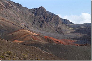
We then return to the visitor center that is just below the summit (just below 10,000 feet of elevation).  From here we pick up the Sliding Sands trail which will take us down about 1500ft over 2.5 miles to the base of a cinder cone.  Technically the "crater" we are hiking in is a valley because it was formed by erosion, not the volcano itself.

The hike begins downhill which make the first half easy, despite the elevation.  We get to the cinder cone which is neat to see.  After taking in the view, we start our trek up.  It’s strenuous because of the altitude, but we eventually make it back.  Fortunately it remains cool at this altitude so it’s not too unpleasant.

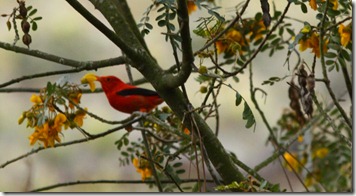
maui472Once we are back in the car, we stop at a couple overlooks on our way down and walk a short nature trail (which is neat because we see some bright red birds).  We finally depart the park and return to the hotel.  We’ll sleep well tonight after all this exercise.

View all the trip photos here:

http://sanjoseabrams.com/photos/MauiDecember2010/

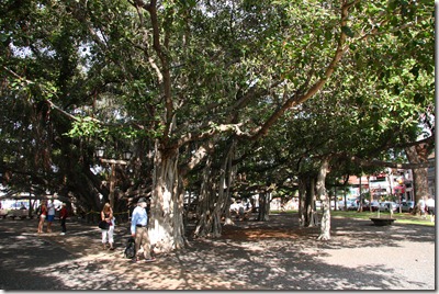
Today we took it a bit easier. After sleeping in a bit, we departed for Lahaina, on west Maui.  It was a little more than a thirty minute drive.  The town was big during the whaling days.  There are still some historic sites to see.  We check out the old prison and courthouse and the highlight of the town, Banyan Tree Square.maui313 This contains a huge tree with multiple trunks and roots.   It’s over one hundred years old.  We also visit the Wu Hing house in the old Chinatown.  The house is neat and has items from the Chinese population that lived in Lahaina back in the whaling days.  The best part are the movies out back.  They have some movies made by Thomas Edison of Hawaii.  These films are over a hundred years old.

After a yummy lunch and gelato stop, we continue up the coast to a beach for L’ to snorkel.   I hang on the beach while she swims with the fishes.  We then return back to the hotel and get dinner.  Tomorrow we are off to the top of the volcano.

View all the trip photos here:

http://sanjoseabrams.com/photos/MauiDecember2010/

There was a choice in how to return to Kihei.  We could drive back the way we came, retracing our steps, or continue along the backside of the island and make a complete loop.  The waitress at dinner the night before recommended the full loop.  We proceeded to go this way, despite the warnings about narrow roads, dirt roads and one lane bridges.  It turned out that all these warnings were greatly overblown.  Even the supposed unpaved part was minor and easy.  Our biggest issue was getting our car stuck in the mud before we even began our drive on the backside.

maui294I was driving and L’ wanted to find a waterfall that we did not see the day before.  She saw a driveway that might be a parking area to get to the waterfall and I turned in.  Thanks to the heavy rainfall the night before, the ground was wet and muddy.  The turn in was a mistake.  It was not a pull off, but just a random driveway and it was all muddy. We realized it didn’t seem right before we even got out of the car.  I put the car back in gear to drive us on our way, only the car didn’t move.  We were stick in the mud.

The two characters who were asking why we pulled in to their driveway were eventually helpful.  They helped pull our car back to the road and out of the mud (while I had my stress attack along with visions of our rental car flying down the cliff).  In the end the locals got us out and we gave them some money for their trouble. (Note that if you work for our rental car company and are reading this, none of the above actually happened).

maui278Back on our way, we stopped at a few pretty places on the road and had a glimpse of the waterfall we were trying to find in the morning (which was very neat – the waterfall went into the ocean).

The road was nowhere as bad as the hype, and it was quite easy.  We stopped at a Lavender farm Lonely Planet recommended and that was just okay.  We finally made it back to our hotel and it was good to be back in civilization again.  We had definitely earned our umbrella drinks today.

View all the trip photos here:

http://sanjoseabrams.com/photos/MauiDecember2010/

By staying in Hana for a couple nights, we had plenty of time to explore beyond the town.  We had a full day today going to O’heo Gulch, stopping at several waterfalls along the road, visiting the grave of Charles Lindbergh, and hiking to a red sand beach.  It was indeed action packed.

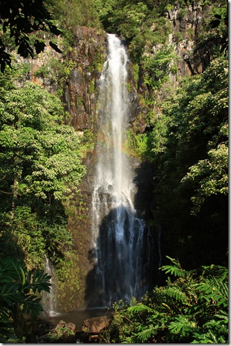
maui131We departed on our adventure to stop at a roadside waterfall. It is called Wailua Falls and was right by the road.  The sun was out and there was a rainbow through the waterfall which was very neat.  After taking the required photos, we departed for O’heo Gulch. 

O’heo is located in a national park so we pulled out our annual parks pass and ID only to determine that L’ had pulled a Zenia- she forgot her purse in the hotel room.  After driving back to get it, we were on our way again.

O’heo Gulch has been known as the "seven sacred pools".  This is wrong on two out of three accounts.  There are more than seven pools and they were never sacred to the native Hawaiians.  They are in fact pools and still very neat.  There are cascading water flows and pools where some of the earth eroded away.  The water is chilly, but refreshing in the hot weather.  We explore the lower pools and since we are here in the morning, it is not crowded. 

After a break for lunch, we start off on about a two mile hike (each way) to get to a couple of bigger waterfalls.  Except for some rain when we finally reach the furthest waterfall, it remains sunny and warm.  The waterfall is well worth the hike in.  We make it out in less time than going in and take in some views along the trail.

We now hunt down the grave of Charles Lindbergh who, battling cancer, lived out his final days on Maui.  The grave is out behind a small church.

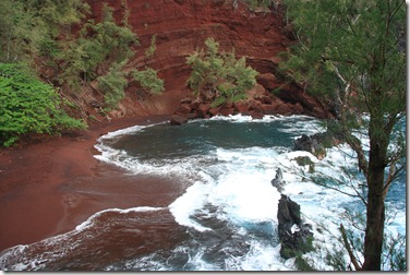
maui235Heading back towards the hotel, we search for the Red Sand Beach.  Our gps comes through and it’s just down the street from the hotel.  The short hike down is a little steep, but nothing too bad.  The beach is very pretty, even in the rain (and much better than the green sand beach we saw on our last trip to Hawaii).

By now we are sufficiently stinky and hungry that we return to the hotel to clean up and find food.  Tomorrow we return to Kihei.

View all the trip photos here:

http://sanjoseabrams.com/photos/MauiDecember2010/

For our first full day in Maui, we tackled the Road to Hana.  Hana is in Eastern Maui and the drive there is known for its scenery.  We had  a guide book, maps, and GPS, yet still managed to confuse ourselves.  It turns out that the road changes name and mile markers.  Unclear to us was that the guides we had (which indicate stops by mile marker), begin AFTER the road changes name and the mile markers reset.  Once we figured this out, then everything made sense and we were in sync with our navigational aids.

maui063

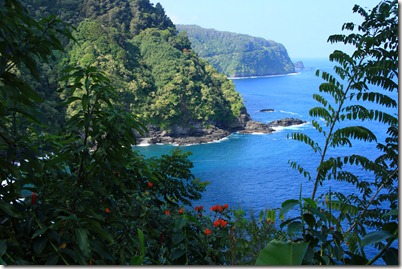
The road is very pretty and there are numerous vistas and stopping points along the way.  Thanks to our mix up in the morning we even caught some surfers enjoying the waves.  We took nearly all day to get to our hotel in Hana. By this time, we were ready for showers and some much needed food,

View all the trip photos here:

http://sanjoseabrams.com/photos/MauiDecember2010/

Our day started with a wake up time almost the same as during the work week.  We got to the airport with plenty of time and the flight was uneventful.  The most painful part was getting our rental car.  It took longer to do this than to actually purchase L”s car.  In the end, we had our car and were ready for our week on Maui.

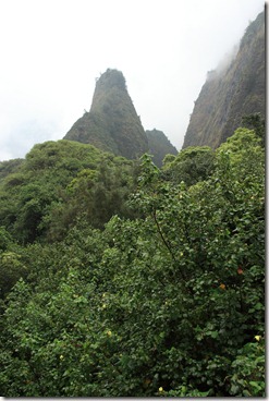
maui016From our pre-planning, we had identified ‘Iao Valley as a good stop on our way to the hotel.  It began to rain, but was manageable (unlike home, it’s warm, so getting wet is not nearly as unpleasant).  We explore all of the very short trails.  The main point of interest is the giant phallic rock.  It’s misting out, so we make a note to return if we have time and the weather improves.

With less hiking than anticipated, we have some spare time.  We take in the bonus stop of the sugar museum.  Sugar was the primary economic engine until tourism surpassed it after the advent of the jet airplane. The museum was small, but interesting.  The sugar crop workers had what we would consider a nightmare work schedule: five days off a month and a ten hour work day.  No wonder they were worried about a worker strike.  Not surprisingly, they had to bring in a foreign work force to fulfill the labor needs. Just goes to show that exploiting cheap foreign labor is hardly a new phenomenon.

Finishing the museum right as it was closing, we head to the hotel.  After cleaning up, we go for dinner which is quite good.  We then pick up food for breakfast and snacks and return to the hotel.  Tomorrow is a full day adventure as we take the road to Hana.

View all the trip photos here:

http://sanjoseabrams.com/photos/MauiDecember2010/

« Previous PageNext Page »